The Burstall Pass hike happened by accident. On a summer Sunday our extended family of four made the two-hour drive to Kananaskis Country with the specific intent of hiking up to Chester Lake. But once we got to the parking lot we saw a trail closed sign because of bear activity. Rather than drive any further we made the decision to hike to Burstall Pass as the trailhead is directly across the road – and it was open. Even better, there were no warning signs of recent bear activity.
Burstall Pass is the first hike I’ve ever done where I had no clue about what we were getting into. I hadn’t brought a map (as I knew the trail to Chester Lake quite well) and didn’t even know how many kilometres we were about to hike.
It turned out to be very straightforward, but it was also a lesson to pack a map or have a hiking app on your fully charged phone like Organic Maps – so you have options if you can’t do the hike you planned.
This post includes some affiliate links. If you make a purchase via one of these links, I will receive a small commission at no extra cost to you. Thank you very much for your support.
Burstall Pass trail details and difficulty
Length of trail: 15 km (9.3 miles) round-trip
Elevation gain: 480 m (1,575 feet) elevation gain
Level of difficulty: Moderate
Time needed: 4.5 – 6 hours. Kids who hike regularly are are 8 years or older should be able to handle it.
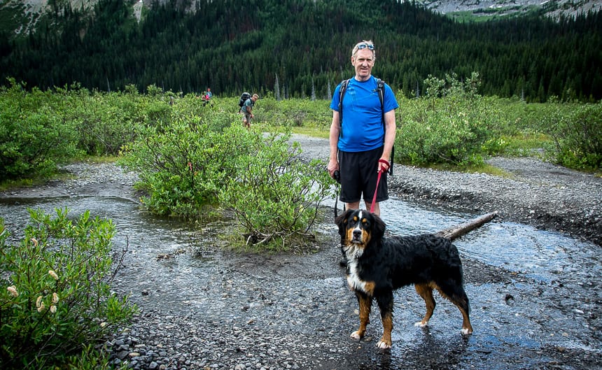
Dogs: Yes, allowed on a leash
Don’t forget: Hiking poles, water sandals and the hiking essentials
Map: Gem Trek Kananaskis Lakes
Nearest lodge: Mount Engadine
Camping info: A Complete Guide to Camping in Kananaskis
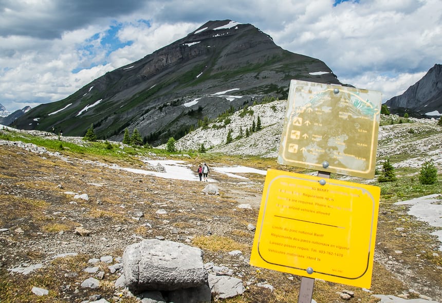
Permits: You will need a Kananaskis Conservation Pass to do the hike. You can purchase a day pass for $15 or a yearly pass for $90, good for two vehicles registered at the same address.
Before you go: Check Alberta Parks trail reports.
Bikes: Allowed on the first 2.7 km of the Burstall Pass trail. You’ll need to lock them up if you plan to hike to Burstall Pass.
Other hiking options: From Burstall Pass, there are several options to continue hiking including the scramble up Snow Peak.
Sandals: There is a very wet section shortly after you finish a hike up the logging road. Consider bringing a pair of water sandals for this section – though the water is very cold!
When can you hike Burstall Pass?
Hike to Burstall Pass from late spring until the snow flies, sometime in October. One of the best times to hike the Burstall Pass trail would be in September because of the larch display. It is to be avoided when there is snow pack – because of the risk of avalanche danger.
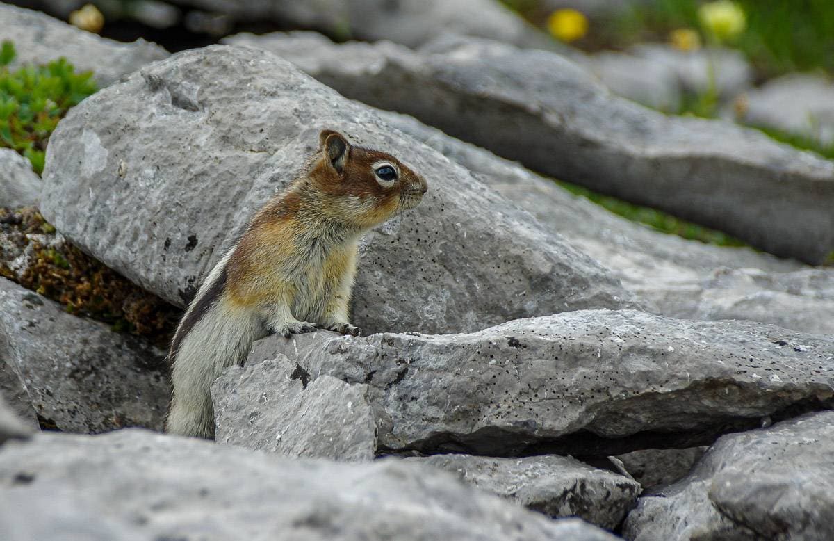
Wildlife on the Burstall Pass hike
When we did the hike we saw golden-mantled ground squirrels at Burstall Pass. They’d obviously been fed a lot, so they were quite aggressive. Keep your daypacks closed and shoo them off.
We didn’t so much as see bear scat, which always makes me happy. You should always carry bear spray that is easy to access. I like to carry it in a bear spray holster, so you don’t set it off accidentally.
Scenic highlights on the hike
- Grand mountain views from the pass including Mount Assiniboine.
- Beautiful wildflower-filled sub-alpine meadows in summer.
- A fun hike through the water section with distant views of the French and Robertson Glaciers.
Burstall Pass hike description
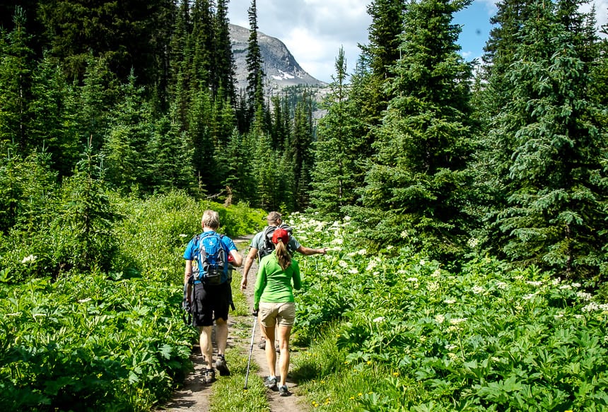
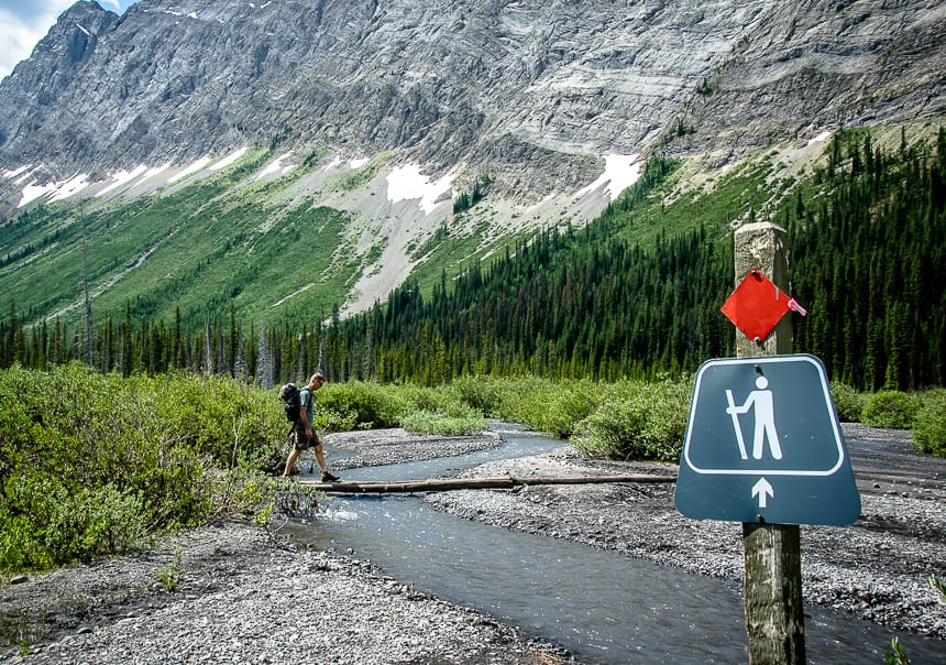
The Burstall Pass hike starts on a berm beside Mud Lake. Walk across the berm (dam) looking for the hiker sign. You end up on an old road for around 2.5 km – at which point it tapers to a trail.
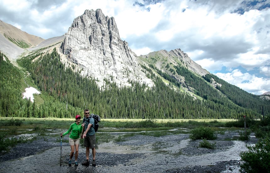
If you’ve biked the first few kilometres, you’ll see a place to lock up your bikes just as it narrows. Before that look for several side trails down to all three of the Burstall Lakes, though it’s hard to get to the shore of at least two of them because it’s so wet.
The first few kilometres of forest according to Graeme Pole, author of Classic Hikes in the Canadian Rockies, is supposed to be good for birding. When he did the hike he heard “warbling vireos, hermit thrush, boreal chickadees and the drumming of three-toed woodpeckers.”
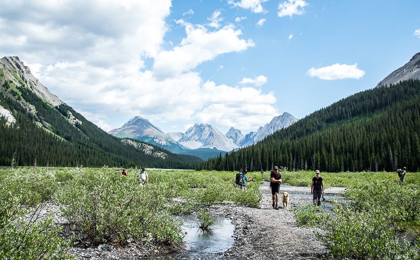
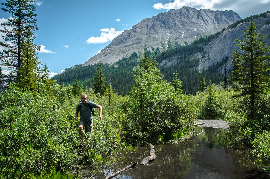
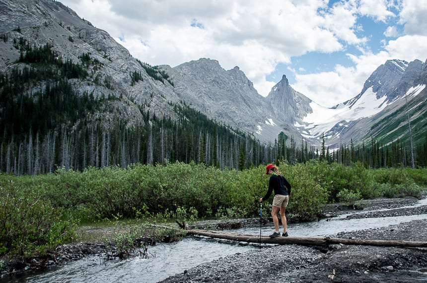
When you come to the end of the forest section, you’ll reach the wet area – the alluvial fan of the Robertson Glacier. Those of you with route-finding skills could come back and hike up the glacier another day.
This is where you might want to slip on a pair of sandals and pull out your hiking poles so you can check water depth. If you look carefully, you will see hiker signs leading the way across the floodplain. On a hot summer day, this section of the Burstall Pass hike feels very cooling.
The wet section on the hike
We used the hiking signs as a reference, but went considerably off-course trying to find narrow sections of stream to jump on the wet section of the Burstall Pass hike. It’s about half a kilometre across but it takes a lot longer than normal hiking unless you’re wearing water shoes. This section is particularly wet in early summer and during glacial melt in August.
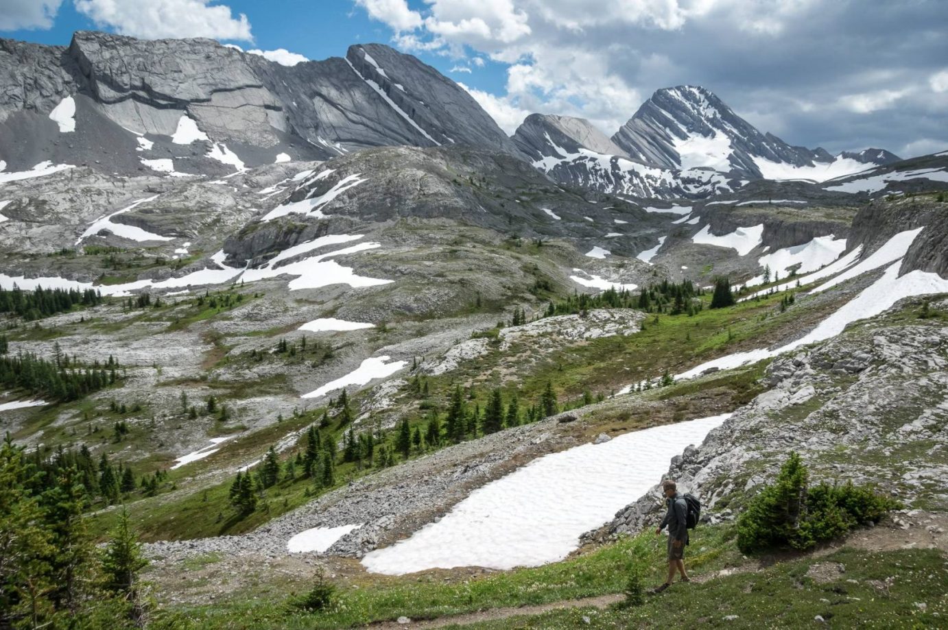
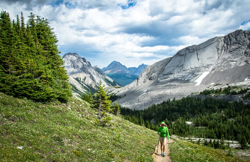
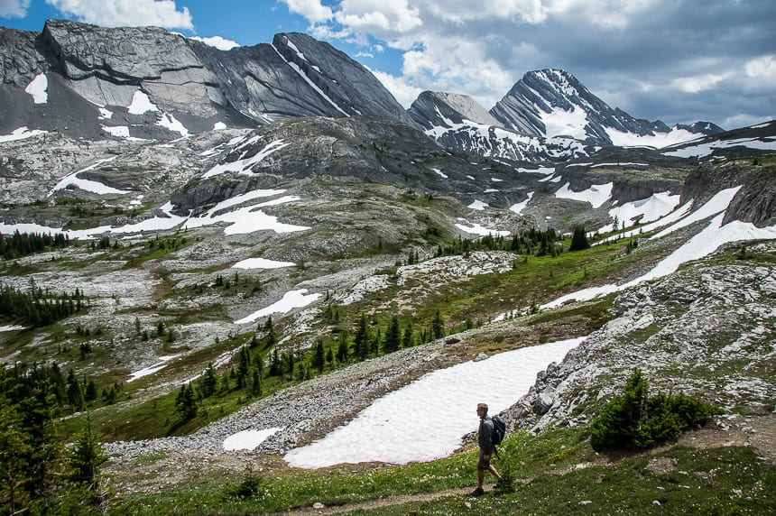
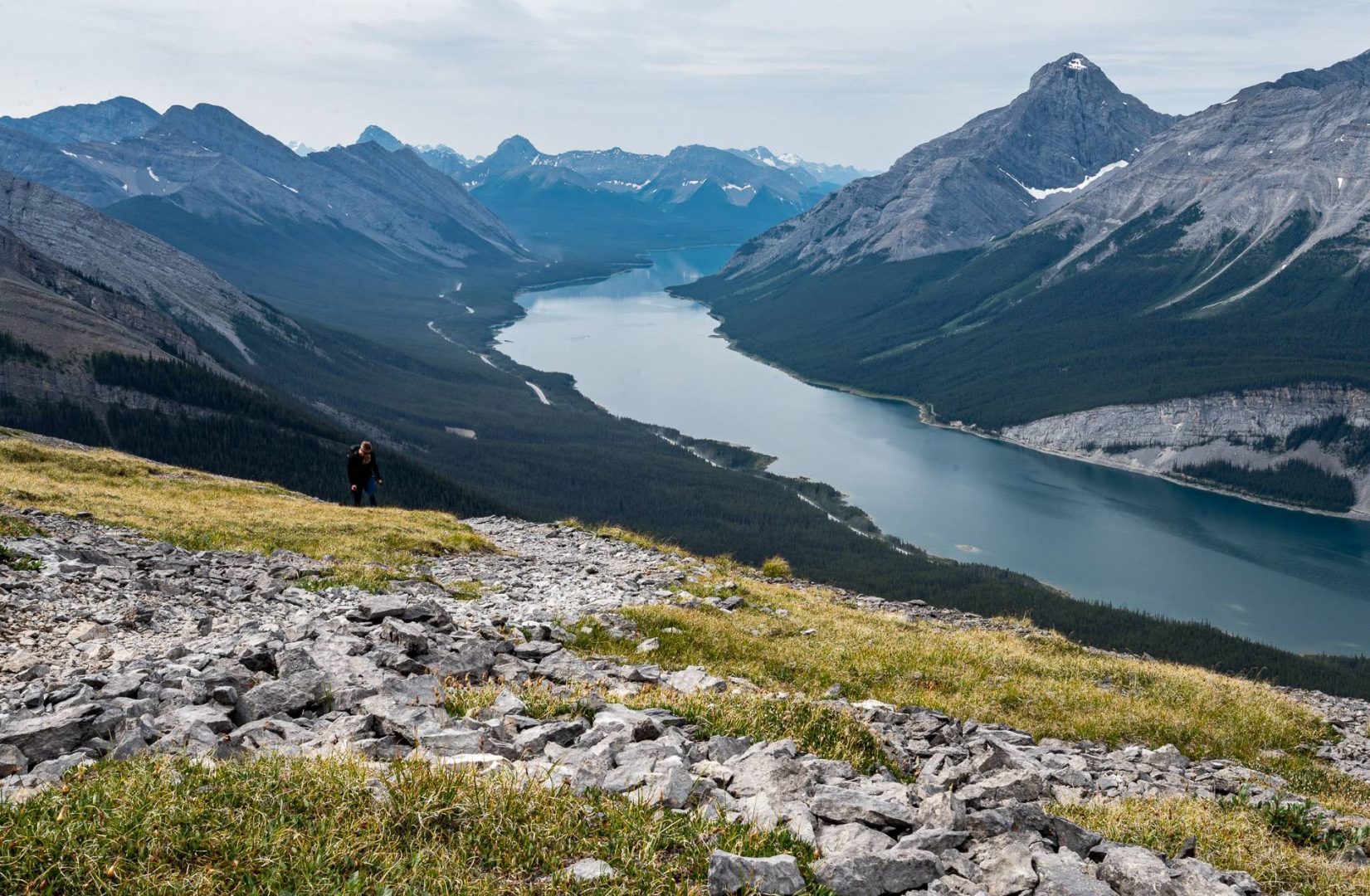
Once you emerge from the floodplain you start climbing towards Burstall Pass, though it’s never overly strenuous. After about 30 minutes you arrive at a sub-alpine meadow, with a little snow still around. From there the hiking gets more interesting as you climb over limestone benches, lined with wildflowers.
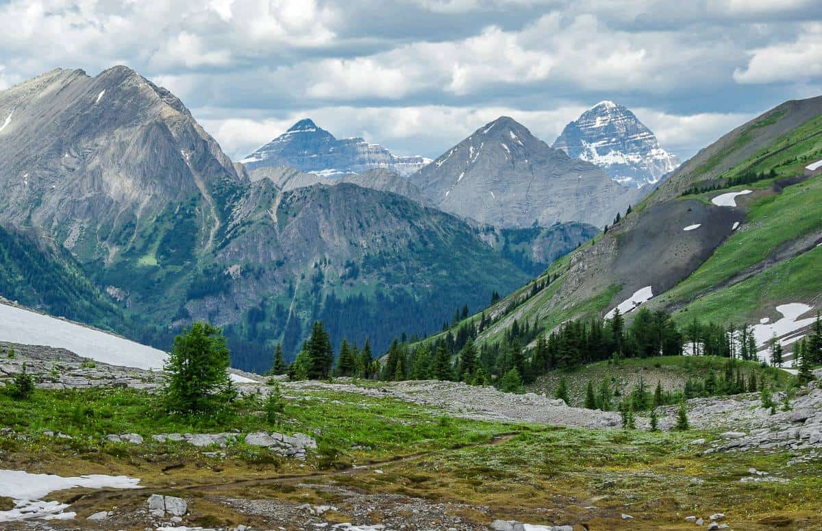
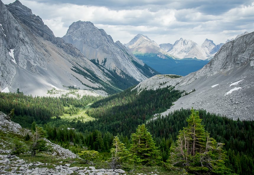
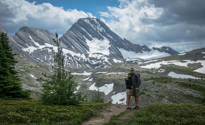
You’ll be stopped in your tracks by the views but continue on to reach the pass at 2,380 metres. On the other side of the pass is Banff National Park and a trail that continues around a sinkhole to Leman Lake.
Before reaching Leman Lake you’ll cross the Palliser Pass Trail. There are loads of options if you want to continue for up to several days. (See more hikes below at the end of the post.)
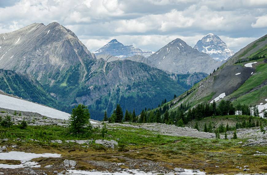
Peaks you can see on the Burstall Pass hike
From the pass you can see Mt. Assiniboine – the sixth highest mountain in the Rockies. Looking north are three peaks – Commonwealth Peak, Pig’s Tail (Shark’s Tooth) and Mt. Birdwood while looking south and west of the Robertson Glacier, sits Mt. Sir Douglas.
Allow five to seven hours to do this trip – and a bit more if you want to climb the “Burstall Bump” or head down to Leman Lake.
Getting to the Burstall Pass trailhead
The trailhead is at Mud Lake, across from the Chester Lake trailhead in Peter Lougheed Provincial Park.
To get there drive 44 km south on the Smith-Dorrien/Spray Lakes Trail from Canmore. The trailhead is on the west side of the highway at Mud Lake. You can also drive Highway 40 to the Smith-Dorrien Trail and continue for 22 km. Be prepared to have a VERY DUSTY car by the time you get to the trailhead.
Burstall Pass location map
Options for more hiking from Burstall Pass
From Burstall Pass you can continue to the top of Snow Peak. To do this requires that you hike another 2 km one way with an added elevation gain of 409 m. Some easy scrambling is required. You need 7 – 8 hours to do the return hike – and that includes the pass. I have yet to do this but would like to.
From Burstall Pass you can also do the Birdwood Traverse, an epic sounding day that ideally requires a shuttle as it’s 19.6 km one way with a reasonable 665 m of elevation gain.
The third option is to descend from Burstall Pass to the Palliser Trail though I’m not sure what sort of shape the trail is in.
There is a fourth option that takes off from just before the bike rack – before you’ve even got to the wet part of the hike. It takes you to the French and Robertson Glaciers but some basic route-finding is required.
5 things I’d take with me on the hike to Burstall Pass
I like something comfortable to sit on at lunch time and swear by my almost weightless inflatable seat cushion.
I like using hiking poles, especially so when a stream crossing is involved. On the Burstall Pass hike in particular, hiking poles are very worthwhile. Invest in a good pair that are collapsible, preferably made of carbon because of their weightless quality.
No matter how the day starts, I always carry rain gear. And I find a brim hat with a chin strap invaluable in the rain or on a hot, in your face sunny day.
I pack a buff – as it’s great for soaking and then wrapping around your neck on hot days, or keeping the hair out of your face.
In summer half gaiters are ideal for keeping pebbles, sand and even some rain out of your shoes.
Another nice addition for those of you who love wildflowers is the book Popular Wildflowers of Alberta and the Canadian Rockies.
Other Kananaskis area hikes you might enjoy
- Pigeon Mountain Hike
- The Beautiful Hike to Buller Pass
- 12 Kananaskis Trail Hikes in Alberta With a View
- 7 Bragg Creek Hikes along Highway 66 in Alberta
- Windtower Hike in Spray Lakes Provincial Park (see photo below)
Click on the photo to bookmark to your Pinterest boards.